Rego Park & Forest Hills
The QueensLink would extend the existing “M” subway line south from 63rd Dr-Rego Park to the Rockaways. A new tunnel would connect the Queens Blvd subway line to the Rockaway Beach Branch right-of-way, then running beneith the right-of-way until Metropolitan Ave. The first station on the new line would be at Metropolitan Ave, afterwhich the tracks would come above ground to pass over the LIRR Lower Montauk Line and Union Turnpike.
Since 2010, the “G” train has terminated at Court Sq. Diverting the “M” train west of the Forest Hills-71st Ave station would free up space for the restoration of “G” train service to Forest Hills from Brooklyn.
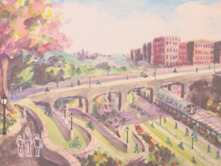
Tunneling to Metropolitan Avenue would make it possible for all the land at White Pot Junction in Rego Park to be used for park space, community gardens, walking trails, and bike trails.
The QueensLink would add 2.25 miles of bike lanes between Queens Boulevard and Forest Park, creating a backbone for safe bike travel in central Queens. This bike infrastructure would integrate into the existing network, supporting the future growth of a network of bike lanes. The Forest Hills Little League could continue to use the land just north of Fleet Street that was once part of the right-of-way.
The Rego Park and Forest Hills section contains 4 parts:
- New 2-tube tunnel under 67th Ave, connecting to the Queens Blvd subway line
- Rego Park Gardens
- Forest Hills Greenway
- Metropolitan Ave Station and Overlook

The Tunnel

When the City built the Queens Boulevard Subway in the 1930s, planners expected to extend the subway system to south and eastern Queens later on. They created provisions for possible branches and extensions at various points at the 63rd Drive station, they built an underground bell mouth to connect the Queens Boulevard lines to a subway extension along the Rockaway Beach Branch right-of-way.
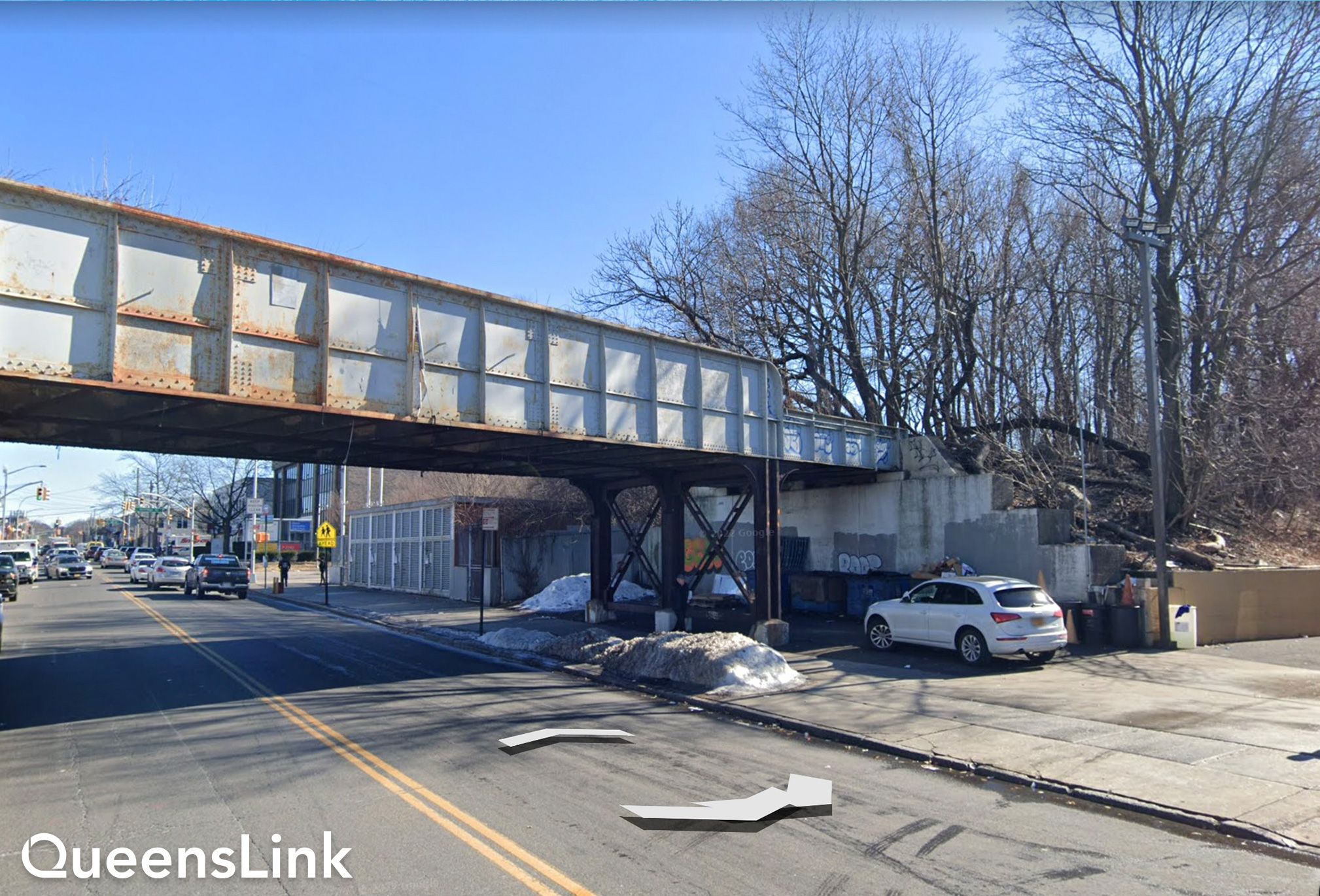
MTA plans called for the tunnel to emerge at Fleet Street, which is now home to the Forest Hills Little League ball fields. This would likely destroy the ball fields while construction is on-going. We see this as a non-starter.
We have devised an alternative plan that would reduce these negative impacts. Our plan routes the new tunnel down 67th Avenue, one block to the east. The natural rise of the hill there would allow the tunnel boring machines to pass further below existing building foundations, reducing the risk of damaging them. It would also shift some construction staging to the Queens Boulevard frontage roads from residential side streets.
Extending the tunnel past Fleet Street to Metropolitan Avenue would also eliminate construction staging at the Forest Hills Little League ball fields. In our plan, Little League practices and games could continue throughout the construction period, and heavy construction trucks would not have to pass through the adjoining residential area. South of Fleet Street, the tunnel-boring machines would run directly below the earth embankment and far enough away from abutting homes to prevent damage to their foundations.
Construction staging would be moved to the large parking lots in the commercial area bounded by Metropolitan Avenue, Woodhaven Boulevard, the LIRR Lower Montauk Line tracks, Union Turnpike, and the RBB right-of-way. Construction vehicles and other trucks could get to the right-of-way without driving on residential streets.

- Tunnel connection to existing Queens Blvd Subway.
- MTA’s 66th Ave alignment. Red Xs show locations where property would be impacted or demolished.
- QueensLink 67th Ave alignment.
- Forest Hills Little League ball fields. QueensLink would leave ball fields intact and continue the tunnel south to Metropolitan Ave.

Rego Park Gardens
When the Long Island Railroad built the Rockaway Beach Branch through Rego Park, they cut a very wide swath along the side of a hill that connects to an earth embankment running south. Today, all of this city-owned land except for the Forest Hills Little League ball fields, lies abandoned and is often used for illegal dumping. Because the QueensLink plan includes building a rail tunnel below the ball fields and under the embankment to Metropolitan Avenue, the entire right-of-way between 63rd Drive and Metropolitan Avenue could be used for open space.
Bird’s-eye, before-and-after view looking south at the proposed Rego Park Gardens.
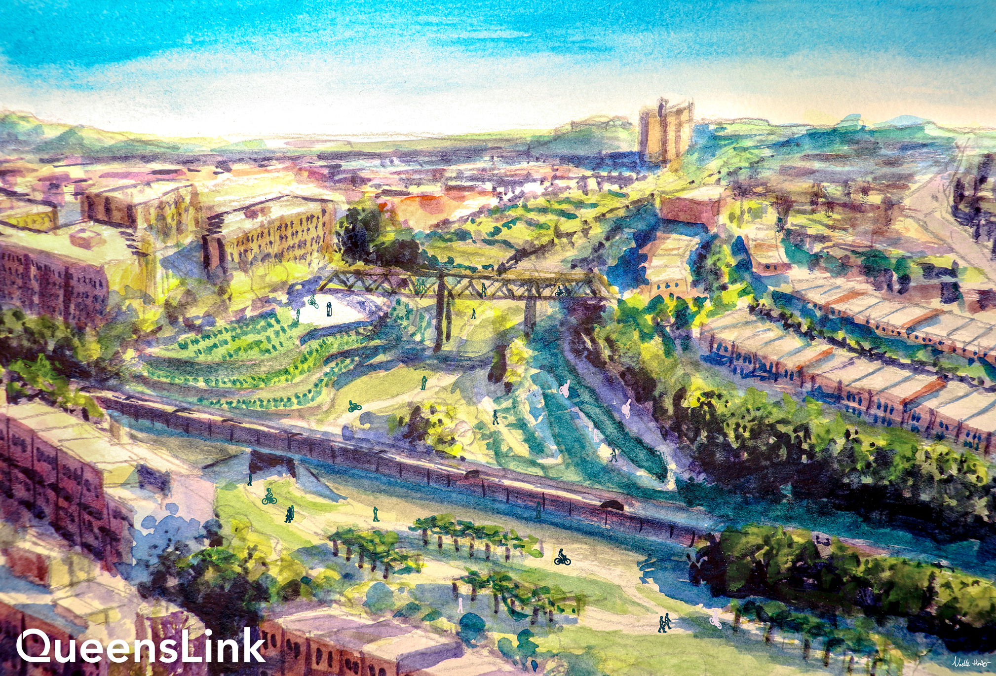

The QueensLink plan reimagines this area as Rego Park Gardens. The design uses the natural landscape to create a bucolic, landscaped greenway connecting 63rd Drive to Fleet Street. North of the LIRR Main Line tracks, the greenway would include bicycle and walking paths, which would continue through the former Rockaway Branch underpass to the larger area south of the LIRR Main Line. There, a natural hollow is surrounded by forest, and landscaped gardens could be built on the eastern hillside.
The walking and bike paths in the southern section of Rego Park Gardens would pass the Forest Hills Little League ball fields and continue over Fleet Street on the former railroad bridge. Park entrances would be placed at 64th Road and Burns Street. A pedestrian bridge could be built over the park to connect neighbors.

Forest Hills Greenway
The Forest Hills Greenway would begin south of Fleet Street. Bike and walking paths, which begin at the 63rd Dr entrance to the park, would continue over the rebuilt Fleet St bridge. Walking trails and bike paths on the former rail beds would be flanked by trees and plantings to provide privacy to neighboring homes, and a security fence would be built on each side of the embankment to prevent trespassing into neighboring yards.

- NYCT right-of-way and maintenance walkway in bored tunnel.
- Tunnel-to-tunnel emergency cross passageways located every 800′
- Forest lined pedestrian pathway
- Bidirectional bike lanes
- Residential backyards on either side
- 9′ metal security fence on either side
At Yellowstone Boulevard, entrances to the greenway would be built into the side of the embankment. The existing Compost Collective and Project Eden community gardens would be incorporated into the new park and could be expanded. An additional park entrance would be built at Nansen and Selfridge Streets.


Metropolitan Ave Station & Overlook
The new Metropolitan Avenue/Parkside station replaces the original LIRR station by the same name. But, while the original was above ground, the new one will be built underground.
Before-and-after view of the proposed Metropolitan Ave-Parkside station.

The new ADA accessible station would be unique: located in the tunnel just before the line emerges above ground, built with a living garden on the roof. The old LIRR bridge spanning Metropolitan Avenue would be replaced with a modern dual bike and pedestrian bridge. This connects the Forest Hills Greenway to the roof of the station, giving pedestrians and bikers safe passage over the busy street to new paths running on each side of the embankment toward Forest Park.
 Bike parking will be available on the ground level. There will be stairs and an elevator connecting the ground entrance of the station to the roof park above. The bike paths which begin at 63rd Dr will continue onto the roof park, crossing over the LIRR tracks and Union Turnpike on a new bridge.

- Northern fare control area (Primary station entry and egress)
- Station platform level
- Rooftop park space with north-south pedestrian and bike lanes
- Elevator connecting park and street levels
- Natural sloped setback of original right-of-way
- Sidewalk and bike lanes along Metropolitan Expeditionary Learning School driveway
- Home Depot parking lot

The Metropolitan Overlook Park will be built on the roof of the subway station and act as the hub between the Forest Hills Greenway to the north and Forest Park in the south. The Overlook will feature pergolas and a planted plaza, with a landscaped slope on the eastern side which will integrate the park into the residential neighborhood and the Metropolitan Education Complex.
An amphitheater and outdoor classroom will be built into the side of the slope. A gently rising dual use path will connect park users and bike riders from the ground to the roof park on the eastern side.
The Overlook will end where the subway portal brings trains above ground, but dual-use walking and bike paths will descend on either side of the tracks, allowing users to safely cross south of the LIRR Lower Montauk Branch tracks and into Forest Park.