
Explore each part of the plan
What is the QueensLink?
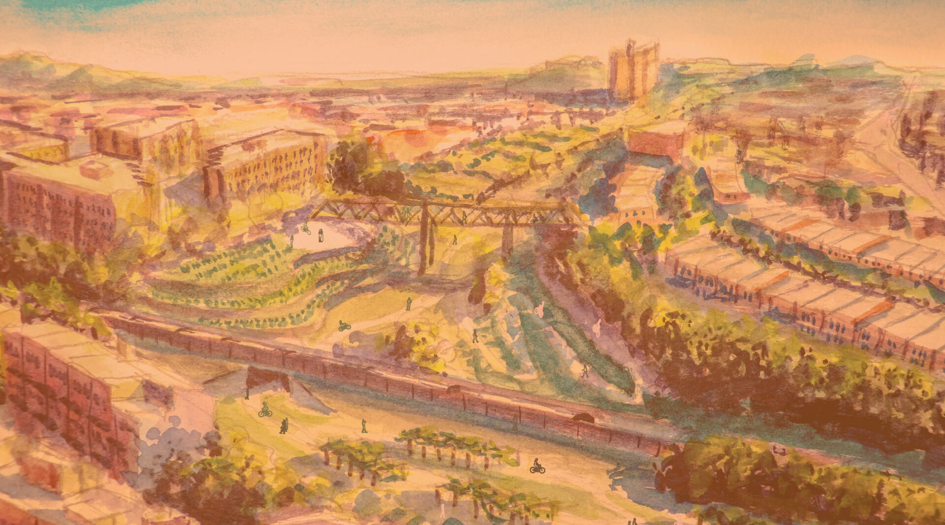
The Rockaway Beach Branch has sat abandoned for over 60 years. Some have called for restoring rail service, while others want to see more park space. Now we have a unique opportunity to build BOTH rails and trails! From Queens Center Mall to the Rockaways, we can connect communities with the borough’s FIRST north-south subway. The project includes four new stations with transfers to the A, J/Z, EFR, and 7 trains, as well as the LIRR, while also creating up to 33 acres of new parks and protected bike paths along the right-of-way.
Why the QueensLink?
Today, residents of southern Queens face some of the longest commutes in the nation! By building a sustainable, cost-effective transit corridor parallel to Woodhaven Boulevard we can significantly reduce car congestion and emissions. This vital project will provide subway access for at least 47,000 daily riders!

4 New Subway Stations
Fast, Affordable, Convenient Transit Access
Sick of the Q52 and Q53? QueensLink can help! An M train extension would turn slow, infrequent bus trips into rapid, reliable subway rides. By connecting the E F R 7 in the north with the A J Z in the south, QueensLink makes travel across the borough faster and easier.
As an added bonus, this plan allows the G to return to Forest Hills, increasing the frequency of local trains by 33%. QueensLink also means over twice the amount of service for the Rockaways! The M would provide much-needed access for Rockaway residents and effortless trips for beach-goers.
The Rockaway Beach Branch is one of the few untouched rail lines left in NYC. Building on an existing right-of-way is significantly cheaper than constructing a new line from scratch. You can’t get more affordable than that!


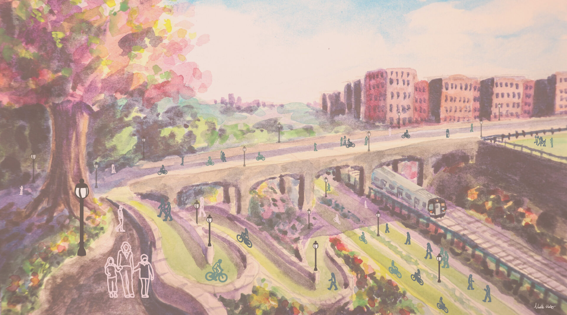
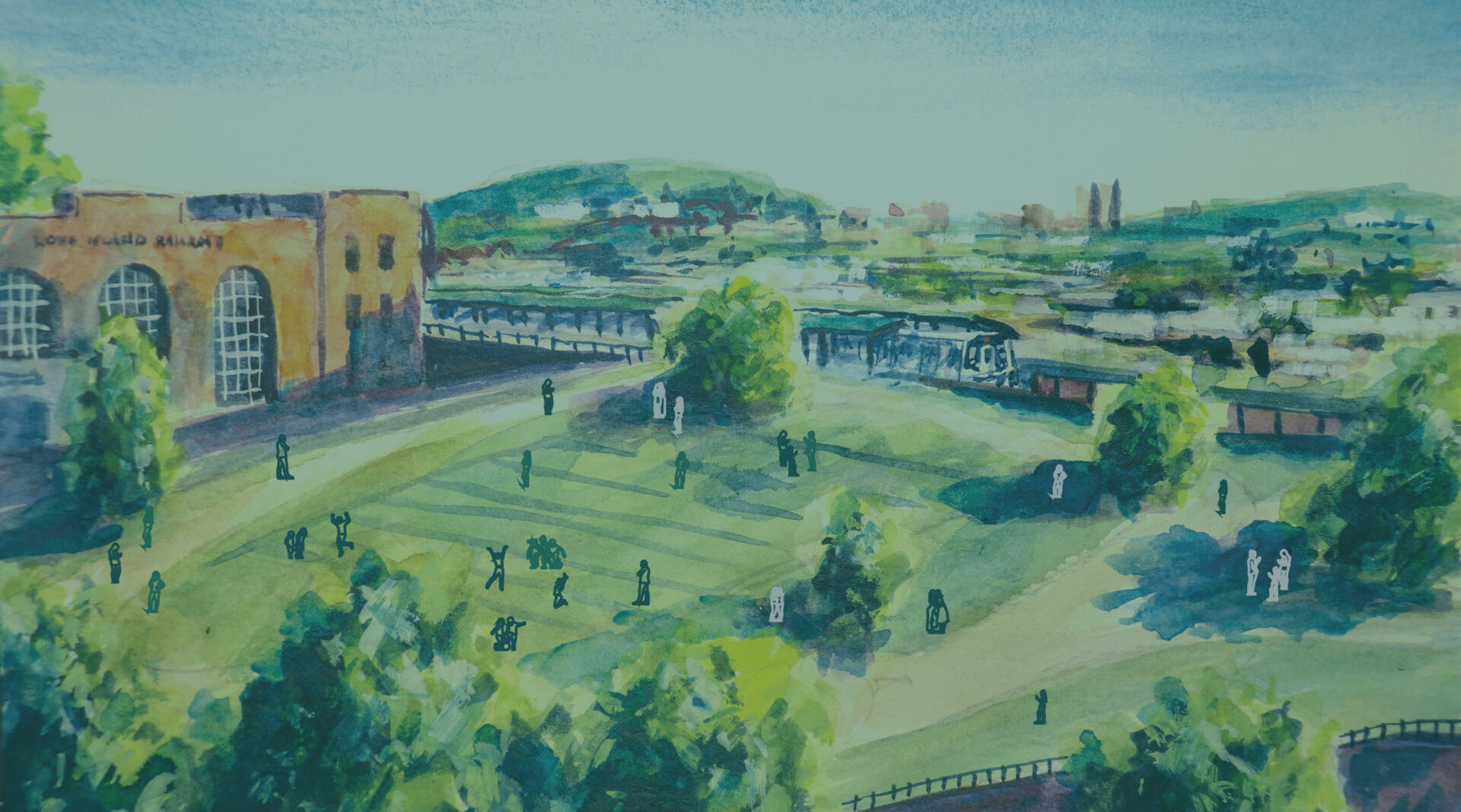
33 Acres of New Parks
Safe, Open, Vibrant Community Spaces
Explore the winding pathways of Rego Park Gardens, the rooftop oasis of Metropolitan Overlook, and vibrant foliage of the Ozone Park Viaduct! Play some soccer at Atlantic Green, picnic with the family in Forest Park, or make your way to the beach!
With community gardens, outdoor learning space, expanded little leagues, and a network of protected bike paths, the possibilities are truly endless! In addition, QueensLink’s method of combining subways and greenways makes it faster and safer for all types of travel.
Based on community input, we’ve taken considerable care to ensure that homes along the right-of-way are completely protected from passing trains and park-goers. Living sound barriers throughout the route keep subways and the park fully separated from backyards. Ample lighting also helps make the design safe and inviting for everyone!


Projects That Inspired Us

The Camden Highline is a proposed elevated park along an active railroad viaduct. The park runs .75 miles from Camden Town to Kings Cross. Unlike the High Line in New York City, passenger trains will still operate on the adjacent tracks, while the unused section will be converted into a pedestrian greenway.

Olhone Greenway running below the BART. Oakland, CA. Image courtesy of Google.
The Ohlone Greenway is a walking and biking path running 4.5 miles through Oakland, CA. Built at the same time as the Bay Area Rapid Transit (BART) extension it runs along the former right of way of the Santa Fe Railroad which was used for BART. The Ohlone Greenway covers BART tracks in some places and runs below the elevated tracks in others.

MBTA Orange Line running below the Southwest Corridor Park. Image courtesy of Bing.
The Southwest Corridor Park and Orange Line extension is a 4.6 mile long parkway and transit line extending through Boston’s Roxbury neighborhood. It was the Phoenix rising from the ashes of the canceled Southwest Expressway plan which would have displaced hundreds of families and divided a neighborhood. The project featured a rerouted below grade Orange Line and Amtrak’s Northeast Corridor with parks along side and build above the train line. Instead of dividing the neighborhood the park and transit serve to knit it closer together.

A railroad viaduct which runs through the heart of Berlin could have been a divider, but instead the Germans have reused the ground floor spaces for retail, bars and restaurants with outdoor seating. This knits the neighborhood together.

An above ground railroad once divided the neighborhood of Sants, in Barcelona, Spain. Burring the line proved too costly, so an innovated park was designed to be built as a roof on top of the rail tracks. The park features walking paths and hanging gardens. The surrounding structure also reduces the noise the trains make as they pass through the neighborhood.

MARTA West End station features new soccer fields which serve underserved youth in Atlanta. Image courtesy of MARTA.
In 2018, in an effort to bring free soccer programs to underserved youth, the Atlanta based not-for-profit Soccer in the Streets partnered with the City of Atlanta and MARTA to develop an empty parcel of land below the elevated metro tracks at the West End station into two soccer fields.

SkyTrain's Expo Line running above the BC Parkway. Image courtesy of Google.
The BC Parkway is a 16.1 mile walking and biking path running below the elevated Expo Line of Vancouver’s SkyTrain. It connects Vancouver with suburbs New Westminster and Surry.

Rendering of proposed new park space as part of the Underline. Image courtesy of the Underline.
When Miami’s Metrorail opened in 1984 it featured a walking and bike path below the elevated tracks called the MetroPath which runs for 10.5 miles. After years of neglect a push was made to renovate the path and it was rebranded as the Underline.